CASE STUDIES> ANJI BUREAU OF WATER RESOURCES
Case Study: Anji Bureau of Water Resources Combines Autonomous Drone Infrastructure and Artificial Intelligence to Streamline Water Utility Operations
Leveraging A2Z Drone Delivery’s highly scalable A2Z AirDocks, the water utility deployed a network of drone docks that supports multi-mission drone fleets and is shared by multiple municipal departments simultaneously.
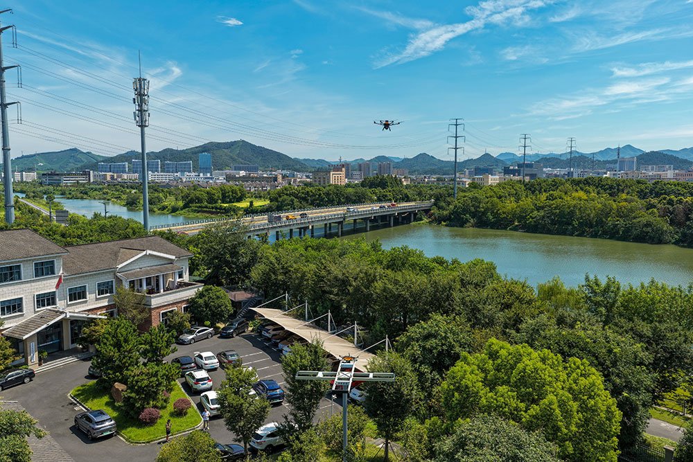
An A2Z Longtail Patrol drone takes off from the A2Z AirDock Quad on an autonomous waterway patrol.
Customer: A2Z Drone Delivery Supports Anji County Municipal Services
Background
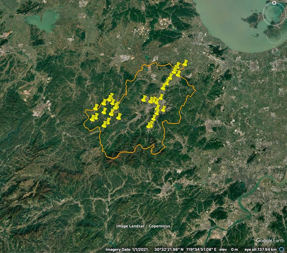
In late 2024, the Anji Bureau of Water Resources, in Anji County outside Shanghai, China, deployed the world’s first A2Z AirDock network to automate routine patrols of its waterways, reservoirs, and tributaries. The initial phase of construction erected eight elevated A2Z AirDocks, enabling a small fleet of A2Z Drone Delivery Longtail aircraft to conduct nonstop autonomous patrol missions across the 23 miles of contiguous waterways. The initial trials of the autonomous drone services were so embraced by the respective stakeholders that the dock network quickly grew to 15 docks, and now, in 2026, it boasts 34 AirDocks that bring autonomous airborne services to the entire county of almost 1,000 square miles, and is shared by multiple municipal departments. By sharing the core dock infrastructure between multiple departments, the county is able to spread operational costs across multiple departmental budgets.
Customer Needs: Expanding Survey Scope
As the lead customer on this shared A2Z AirDock network, the Anji Bureau of Water Resources initially focused its drone operations on patrolling a small trial portion of the county’s urban waterways, reservoirs, and tributaries. Monitoring had traditionally been conducted by department staff in ground vehicles and on foot. Routine inspection of the waterways weaving through the urban terrain was labor-intensive, often taking several days, and some hard-to-reach areas were rarely visually inspected at all. With the addition of the network of A2Z AirDocks, and companion Longtail Patrol aircraft, the department was able to trim the inspection time for this 120 square mile section of its system to just 1.5 hours.
After proving the efficiency of the Longtail’s repeatable autonomous patrol capabilities supported by the automatic-charging capability of the AirDocks, the department sought to expand the reach of the dock network to the full reach of the system’s rivers and reservoirs. Now, with a network spanning almost 1,000 square miles, beyond-visual-line-of-sight (BVLOS) survey drones deliver a full inspection of the water system in just a couple of hours.
The drone and dock infrastructure are crucial to streamlining the collection of aerial video data of the water system’s rivers and reservoirs, but it’s a sleek deployment of artificial intelligence that delivers the true manpower savings. As a single operator manages the department drone fleet and dock network from a remote operations center, live video flows through a comparative AI tool that reports changes since the last survey and flags points of potential interest. The system provides department staff with reports of illegal dumping, unauthorized boating or swimming in the protected waterways, any unauthorized construction, noticeable land erosion, and spots new algae blooms. Department staff can then align any necessary response to problem areas.
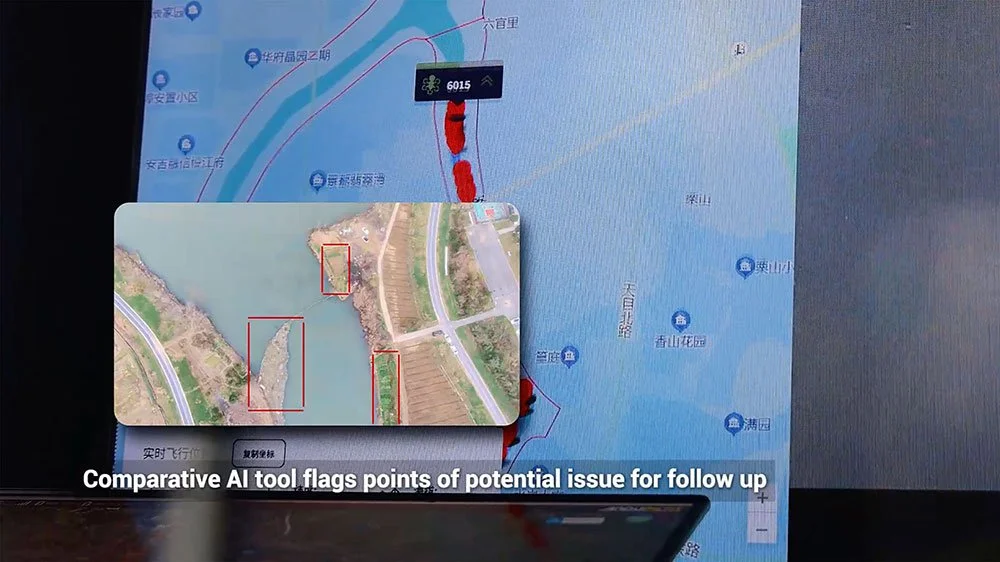
A single operator manages a fleet of autonomous Longtail aircraft from a remote operations center while comparative AI tools flag potential points of concern within the patrol data.
“The initial phase of our AirDock network was transformative for our monitoring program,” said ChongShan Wan, Director of the Anji Bureau of Water Resources. “We realized significant savings in manpower and resources by conducting this monitoring from the air, so the decision to expand the project’s reach beyond the urban center was an investment we had proven to be valuable. The initial trial also demonstrated that the AirDock network could simultaneously support the unmanned aerial missions that other departments required.”
Sharing Autonomous Drone Capabilities Across Municipal Government
The A2Z AirDocks are unique among drone-in-a-box systems. Not only does each AirDock allow up to four drones to perch on an elevated frame to recharge batteries far out of the reach of people on the ground, but they are designed to be sharable between shareholders (whether various enterprise users or multiple governmental departments) conducting a variety of UAV services.
Adapting the onboard payload to the needs of the first responders also incorporated a high-powered LED light for nighttime operations and a megaphone to allow operators to communicate with people on the ground when necessary. With these specialty drones among the growing municipal fleets, local emergency services leverage infrared camera-equipped Longtail aircraft to conduct routine and repeatable search and rescue operations. Additionally, the Anji network now also supports the county public works department inspection teams by detecting cracks or errant debris in roadways, all from altitude.
Results
Completing the latest phased expansion of this A2Z AirDock network brought the county’s drone dock infrastructure to 34 AirDocks that service multiple interoperable fleets of customized Longtail drones. With multiple governmental departments sharing the expanded dock network, the overall hardware investment was able to be defrayed across multiple departmental budgets, making the entire project far more financially feasible for the county. Now, the county is bringing aerial drone assets to bear across almost 1,000 square miles of its territory, while making best use of its all-too-valuable personnel time and energy. Further highlighting the effectiveness of the investment, the County is currently in the strategic rollout phase for another 20 A2Docks to diversify the use cases and expand the reach of the joint operation dock network.
Phase 1
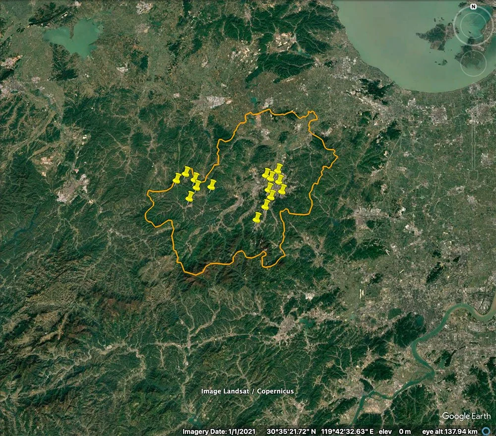
Phase 2