CASE STUDIES> MULTI-MISSION> ANJI COUNTY MUNICIPAL SERVICES PHASE 2
Case Study: Anji County Municipal Services Doubles the Reach of its AirDock Network for Regionwide Multi-Mission Drone Operations
The Second Phase of the Shared Multi-Mission A2Z AirDock Network Expands Service Range to 965 Square Miles While Broadening Mission Capabilities with New Use Cases
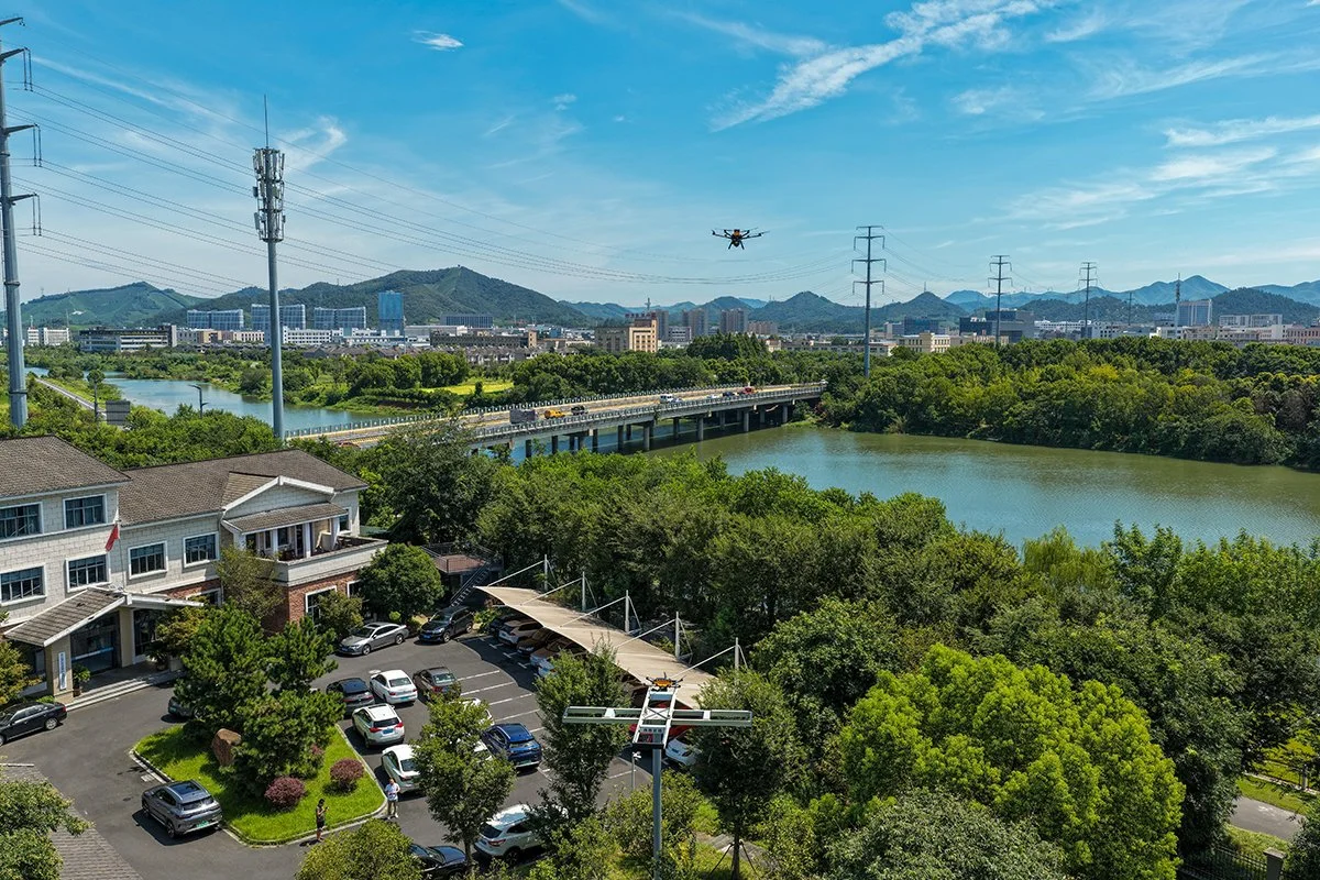
An A2Z Longtail Patrol drone takes off from the A2Z AirDock Quad on an autonomous waterway patrol.
Customer: Anji County Municipal Services and Local Food Deliveries
Background
In late 2024, the Anji Bureau of Water Resources, in Anji County outside Shanghai, China, deployed the world’s first A2Z AirDock network to automate routine patrols of its waterways, reservoirs, and tributaries. The initial phase of construction erected eight elevated AirDocks, enabling a small fleet of two A2Z Drone Delivery Longtail aircraft to conduct nonstop autonomous patrol missions across the 23 miles of contiguous waterways. The sharable dock network was also leveraged by county first responders to monitor traffic congestion and provide rapid response aerial assets when responding to vehicular incidents. When the government agencies were not using the dock network, it became a revenue generator as local restaurants leveraged an independent delivery drone fleet to conduct autonomous last-mile food deliveries from local cafes to the region’s popular eco-resorts. The initial trials of the autonomous drone services were so embraced by the respective stakeholders that the dock network quickly grew to 15 test locations to meet growing demand.
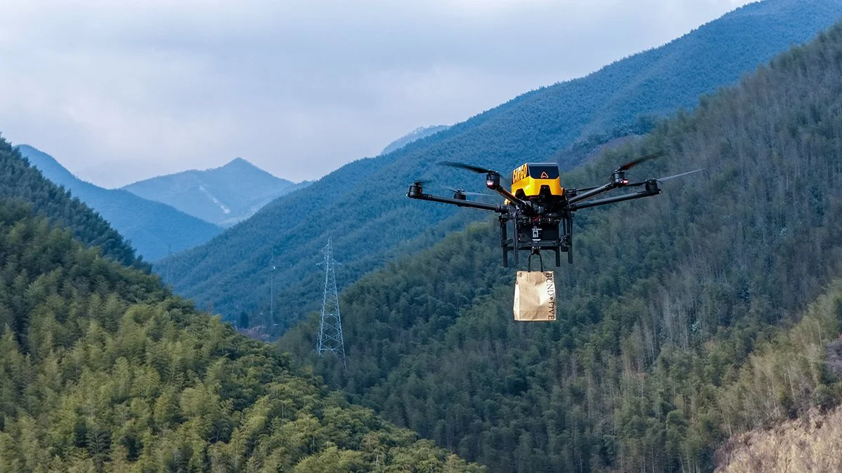
Following a year of testing and trials, the project has now expanded in scope to reach across the entire region. Phase 2 construction has added an additional 19 AirDocks to the region's drone dock infrastructure, bringing airborne services to a 965-square-mile region. New mission capabilities were also incorporated. The network now also supports the county highway department’s inspection teams by detecting cracks in roadways or errant debris in the roadways, all from altitude. Additionally, local emergency services leverage infrared camera-equipped Longtail aircraft to conduct routine and repeatable search and rescue operations. The massive scale of the expanded AirDock network is also unlocking last-mile drone delivery for even more local restaurants and cafes.
Water Resource inspection drones share the AirDock infrastructure with UAVs serving other municipal departments' use cases, and support local restaurant deliveries.
Customer Needs
As the lead customer in the now-expanded project featuring 34 AirDocks, the Anji Bureau of Water Resources initially focused its drone operations on patrolling the county’s urban waterways, reservoirs, and tributaries. Monitoring had traditionally been conducted by department staff in ground vehicles and on foot. Routine inspection of the waterways weaving through the urban terrain was labor-intensive, often taking several days, and some hard-to-reach areas were rarely visually inspected at all. With the addition of the network of A2Z AirDocks, and companion Longtail Patrol aircraft, the department was able to trim the inspection time for this section of its system to just 1.5 hours. After proving the efficiency of the Longtail’s repeatable autonomous patrol capabilities supported by the automatic-charging capability of the AirDocks, the department sought to expand the reach of the dock network to further improve its waterway monitoring mission.
“The initial phase of our AirDock network was transformative for our monitoring program,” said ChongShan Wan, Director of the Anji Bureau of Water Resources. “We realized significant savings in manpower and resources by conducting this monitoring from the air, so the decision to expand the project and reach beyond the urban center was an investment we had proven to be valuable. The initial trial also demonstrated that the AirDock network could simultaneously support the unmanned aerial missions that other departments required, and have an economic impact for local eateries.”
Starting with its initial eight AirDocks, and quickly growing the network to 15 docking stations, the Bureau shared the UAV infrastructure with first responders operating in the urban centers of Anji, and opened the network to local restaurants for food deliveries during government downtime. To support the mission criteria for the waterway patrols, a fleet of Longtail Patrol UAVs was outfitted with daytime high-resolution cameras paired with nighttime infrared cameras. Adapting the onboard payload to the needs of the first responders also incorporated a high-powered LED light for nighttime operations and a megaphone to allow operators to communicate with people on the ground when necessary.
A flyer provided to area resort guests includes a simple QR code linking to an app where they order food from local restaurants for drone delivery.
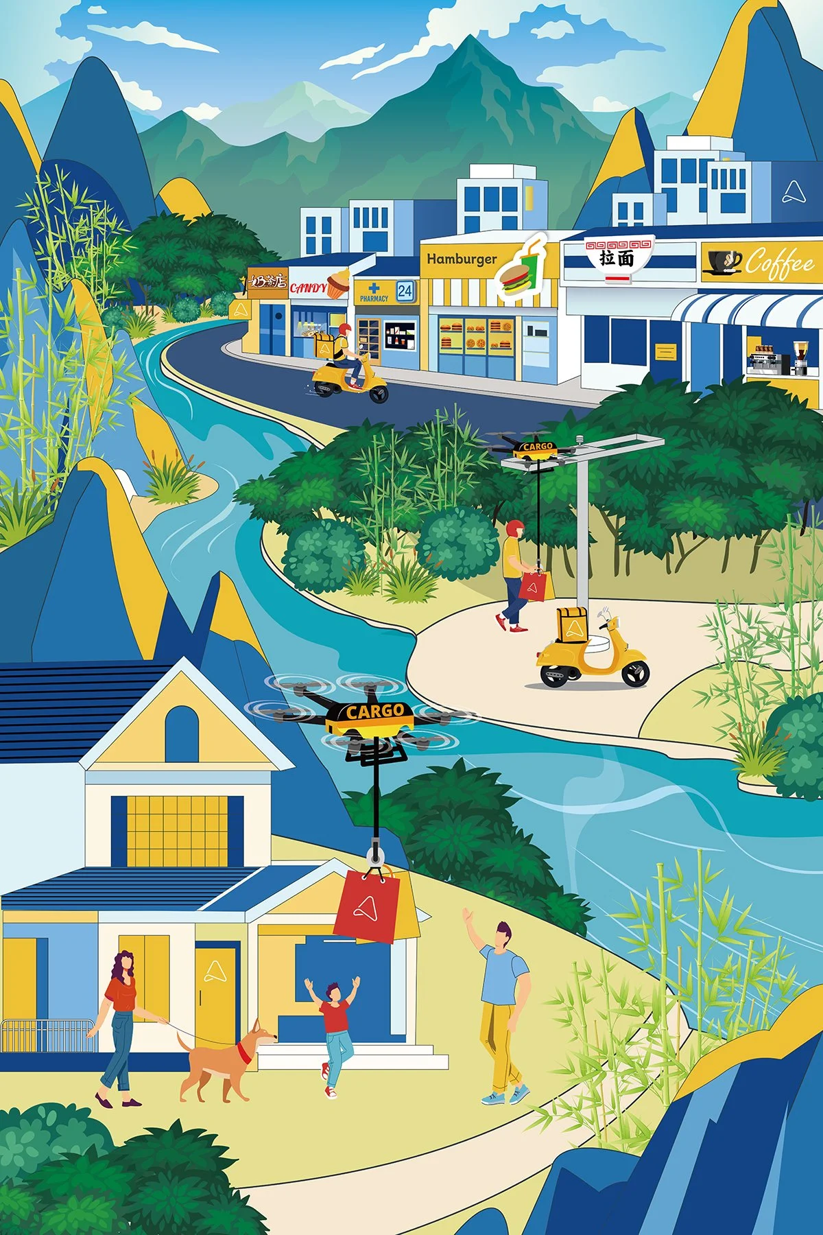
Layering a second small fleet comprised of Longtail Cargo variants, the AirDock network also enabled local restaurants and cafes to offer drone delivery of meals and refreshments to excited customers. The elevated design of the A2Z AirDock Quad and AirDock Dual versions meant the drones’ spinning propellers are kept far from people and property on the ground.
Hotel guests throughout the region are able to place a food order through a Yelp-like app. Once orders are prepared by the restaurant staff, they are brought to the closest AirDock where a delivery drone awaits. When the Longtail lands on the elevated AirDock, it lowers its integrated A2Z commercial drone winch to the waiting restaurant staffer who loads the food onto the patented delivery hook. Eliminating the need for a trained hub operator to handle loading and unloading simplifies the process and makes deliveries more cost-effective for customers. At its final destination miles away, the Longtail Cargo safely delivers orders from altitude, automatically releasing the payload as it is lowered from the winch at the hotel or resort.
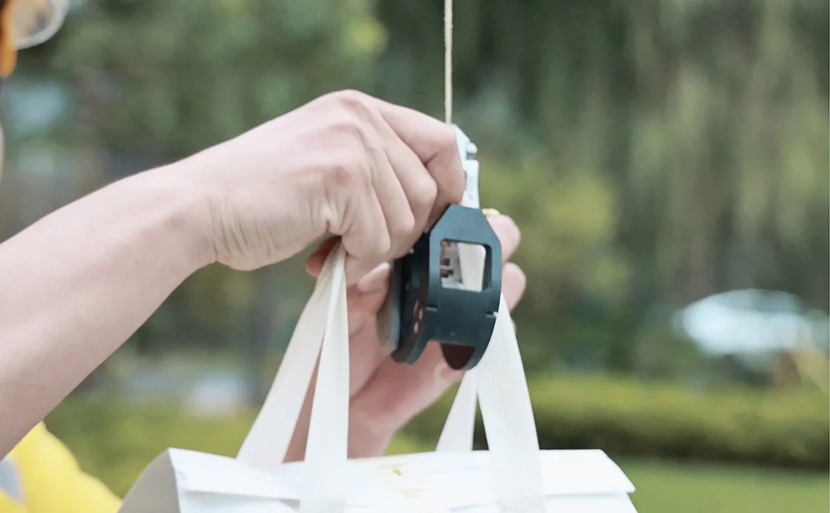
Enabling restaurant staff to safely load food orders themselves eliminates the need for paid hub operators.
Over the course of the trial program, residents and other governmental departments became accustomed to the sight of UAVs conducting daily missions. The success of the trial also drew the interest of other department heads eager to take advantage of aerial assets and the network of AirDocks. As the project entered Phase 2, roadway inspections and search and rescue capabilities would also be integrated with the fleet's mission parameters.
Solution
With the first phase of the project effectively demonstrating the impacts that unmanned systems could have across multiple municipal departments, and for local retailers to boost their bottom lines, the next phase of the project was simply a matter of replication, just on a much larger scale.
Working with local government leaders, the A2Z Drone Delivery team analyzed the target 965-square-mile region that would be served by the Phase 2 expansion and determined the ideal locations for the elevated AirDocks to be installed. Designed to seamlessly blend into a built environment, the AirDocks fit a similar footprint as a standard street light, making them easily integrated into an urban environment. In more remote wooded areas, the AirDocks’ elevated designs enable automatic charging, and payload logistics from high above trees or other potential obstructions. The team determined that a total of 19 additional AirDock Quad and AirDock Dual units would provide comprehensive coverage for all of the stakeholders seeking to operate varying use cases across the shared network. Installing up to three AirDocks per day, the expansion came to life rapidly.
A2Z Drone Delivery engineers also worked with department teams to customize the Longtail Patrol payload to accommodate the new roadway inspection and search and rescue missions. The level of precision detail needed to spot cracks in roadways led the team to upgrade the Longtail Patrol’s onboard high-res and infrared cameras and design a new data workflow to be supported by AI-powered analysis platforms.
This improved AI capability is now also being leveraged by the water resource drones as well. With AI detection occurring in real-time aboard the Longtail UAV, and AI-powered before-and-after comparisons conducted on the cloud, the system is able to identify new algae blooms or potential signs of pollutants in the waterways and autonomously compare them to the existing database. The specific locations of potentially problematic sites are recorded and issued to water inspectors for follow-up inspection and treatment. This process has greatly improved the efficiency of the water resource teams, allowing them to refocus their time on more urgent needs.
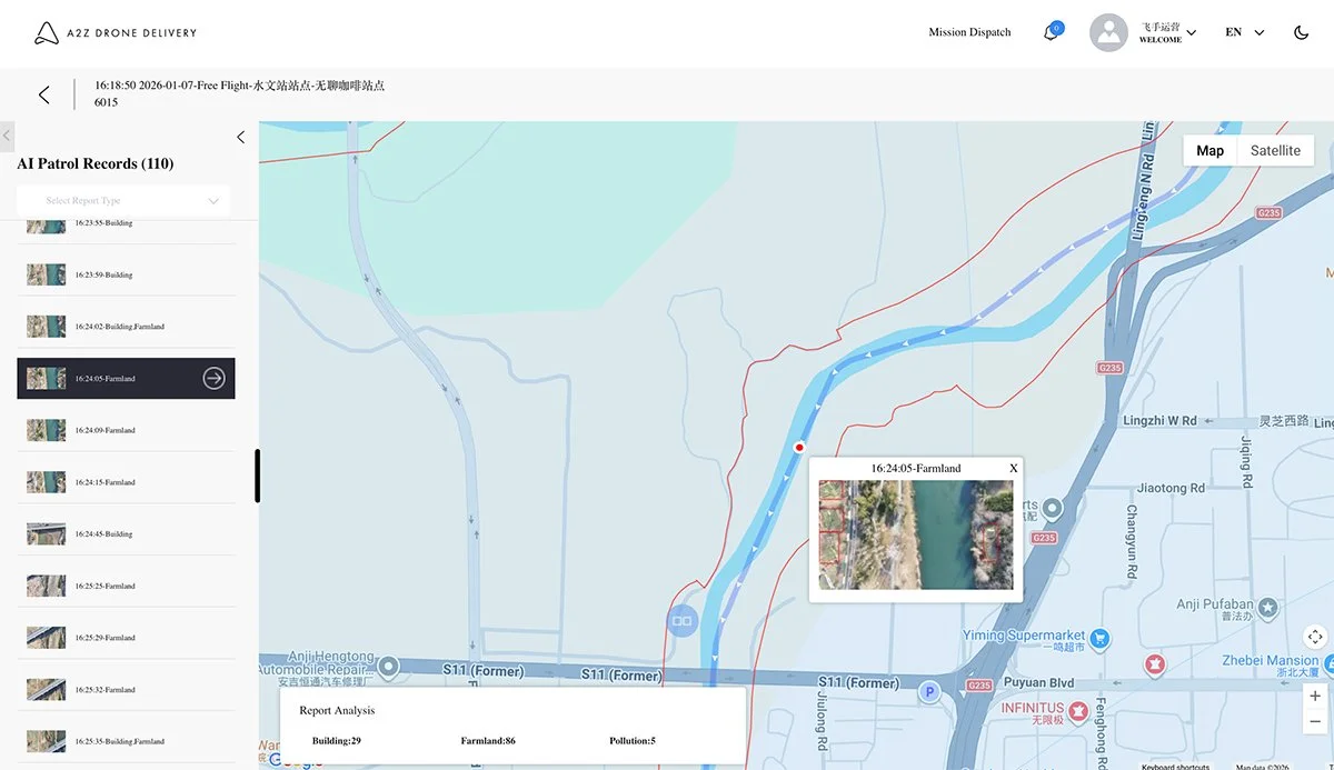
Within the A2Z Mission Dispatch interface, a single operator monitors the entire AirDock network and fleets of aircraft throughout their respective missions.
Results
Completing the Phase 2 expansion of this A2Z AirDock network brought the county’s drone dock infrastructure to 34 AirDocks that service multiple interoperable fleets of customized Longtail Patrol and Longtail Cargo drones. With four governmental departments sharing the expanded dock network, the overall hardware investment was able to be defrayed across multiple departmental budgets, making the entire project far more financially feasible for the county. Now, the county is bringing aerial drone assets to bear across 965 square miles, and exponentially more local restaurants and cafes are taking advantage of the innovative network to stand up even more last-mile drone deliveries across the A2Z AirDock network.
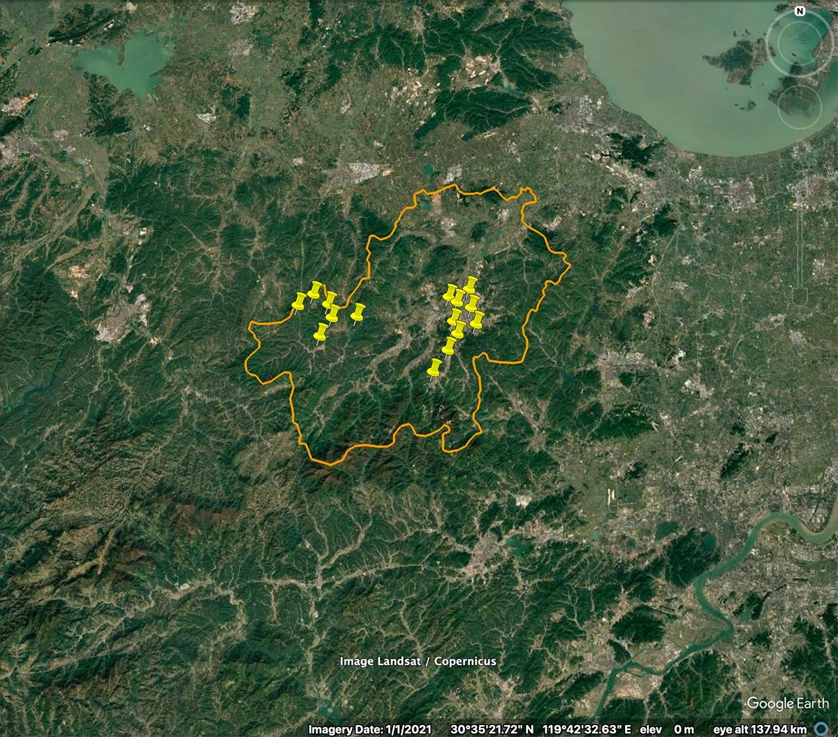
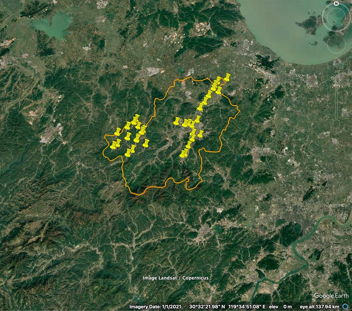
The expansion in Phase 2 of this project now serves an area 43 times the size of Manhattan, with autonomous drone services reaching the entire county of Anji.